Why climate zones differ
Sunlight, spinning air, warm water and mountains.
1. The Sun
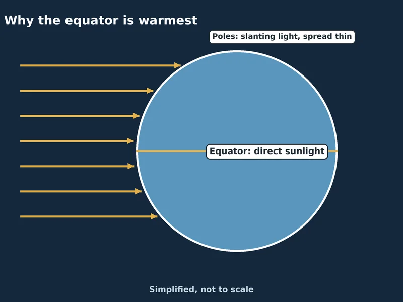
It is driven by uneven heating: the equator gets more direct sunlight than the poles. Met Office: Global circulation patterns
2. Three cells of moving air
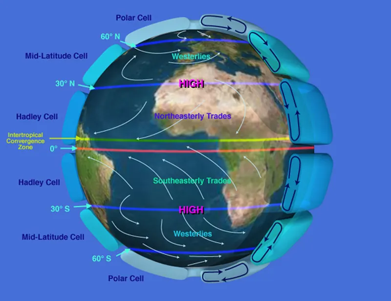
Global circulation is the large-scale movement of air that carries heat and moisture around the planet. Met Office: Global circulation patterns Each hemisphere has three big circulation cells: the Hadley, Ferrel and Polar cells. Met Office: Global circulation patterns
In the Hadley cell, trade winds blow towards the equator, the warm air rises into towering rain clouds, then sinks over the subtropics, making high pressure over deserts like the Sahara. Met Office: Global circulation patterns The Hadley cell reaches from the equator to about 30–40° latitude. Met Office: Global circulation patterns
The Ferrel cell, between about 30–40° and 60–70°, works like a gear between the other two. Met Office: Global circulation patterns The Polar cell is the smallest and weakest. Air sinks at the poles and flows away from them at the surface. Met Office: Global circulation patterns
Earth’s spin bends moving air to the right in the northern hemisphere and to the left in the southern: the Coriolis effect. Met Office: Global circulation patterns
High-pressure bands sit at about 30° north and south and at each pole; low-pressure bands at the equator and at 50–60°. NOAA JetStream: Global atmospheric circulations
The band between 50° and 60°, including the British Isles, tends to be wetter, especially on the west coasts of continents. NOAA JetStream: Global atmospheric circulations
Together the three cells work like a global conveyor belt, shaping the winds and where deserts and rainforests are found. Met Office: Global circulation patterns
Without Earth’s tilt, spin and oceans, the circulation would be one simple loop from equator to pole in each hemisphere. NOAA JetStream: Global atmospheric circulations
The Hadley cell is named after George Hadley, an English physicist who proposed a single circulation for each hemisphere in 1735. NOAA JetStream: Global atmospheric circulations The Ferrel cell was proposed by William Ferrel in 1856, the first to explain the westerly winds between 35° and 60°. NOAA JetStream: Global atmospheric circulations
3. Oceans and continents
The UK is at the same latitude as most of Canada but has a much milder climate, thanks to the Gulf Stream and the North Atlantic. Met Office: Climate zones
The Gulf Stream is a warm, fast Atlantic current that starts at the tip of Florida and carries tropical warmth towards Europe. Met Office blog: What is the Gulf Stream and how does it affect UK weather? It is part of a bigger ocean conveyor belt, the Atlantic Meridional Overturning Circulation (AMOC), driven by differences in water temperature and saltiness. Met Office blog: What is the Gulf Stream and how does it affect UK weather?
As the water cools and gets saltier on its way north, it becomes denser and sinks, then creeps back towards the equator several kilometres down. Met Office blog: What is the Gulf Stream and how does it affect UK weather?
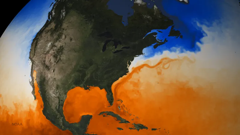
Without the Gulf Stream, the UK’s climate would be much colder. Met Office blog: What is the Gulf Stream and how does it affect UK weather? Cities in Canada at the same latitude as London often have much harsher winters. Met Office blog: What is the Gulf Stream and how does it affect UK weather?
Continental climates are like temperate ones but with bigger extremes, because they sit far inland, away from the calming effect of the sea. Met Office: Climate zones On marine west coasts the yearly temperature range is only about 10–15 °C, roughly half that of the continental interior at the same latitude. Encyclopaedia Britannica: marine west coast climate
The western and eastern sides of a continent can have very different climates, because of the direction of the prevailing winds. Met Office: Climate zones
4. Mountains
Going up, temperature, air pressure, humidity and dust all fall. Encyclopaedia Britannica: highland climate Mountains block moving air. The drier side downwind is called a rain shadow. Encyclopaedia Britannica: highland climate
In Europe the Alps and Pyrenees run east–west, so this climate reaches some 2,000 km inland, into eastern Germany and Poland. Encyclopaedia Britannica: marine west coast climate
Next: the UK and Isle of Man →